Jaujac - Blue Trail
JAUJAC
Jaujac - Blue Trail
Easy
8m
+0m
0m
If you wish to make your own choices of route with the help of your map and compass, please go here.
Embed this item to access it offline
Surrounded by Cevennes greenhouses, nestled between the youngest volcano in the Ardèche and long basaltic flows, Jaujac enchants the visitor with the beauty of its sites.
Situated on the banks of the Lignon, at an altitude of 420 metres, the village has managed to preserve and enhance a deep medieval character. This atmosphere is accentuated by the cobbled streets, the castle of Castrevieille and the castle of Bruget. The central square, lined with majestic plane trees, exudes a very southern atmosphere and comes alive regularly on market days.
Situated on the banks of the Lignon, at an altitude of 420 metres, the village has managed to preserve and enhance a deep medieval character. This atmosphere is accentuated by the cobbled streets, the castle of Castrevieille and the castle of Bruget. The central square, lined with majestic plane trees, exudes a very southern atmosphere and comes alive regularly on market days.
Attachment
- Downloadpdf
Jaujac Bleu Découverte
Description
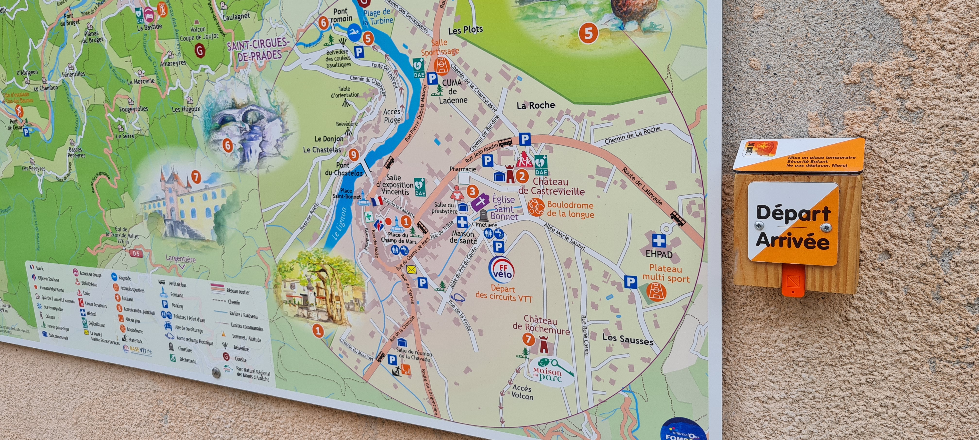
Parcours découverte
Longueur 1,5km
Longueur 1,5km
- Departure : Tourist office
- Arrival : Tourist office
- Towns crossed : JAUJAC
Forecast
Recommandations
Before leaving, check the weather conditions. Be careful with children when crossing the road. Do not leave any rubbish on the site.
If you notice any anomaly on the route, please contact the Tourist Office.
If you notice any anomaly on the route, please contact the Tourist Office.
A compass and/or a map of the course.
Information desks
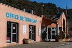
Tourism Office
2 place du Bosquet, Neyrac les Bains, 07380 Meyras
Access and parking
From Aubenas, take the N102 to Lalevade d'Ardèche then turn left onto the D19 towards Jaujac. From the east or north, take the D5 after Neyrac-les-Bains from the N102.
Parking :
Church car park - Castrevielle car park - Post office car park
Report a problem or an error
If you have found an error on this page or if you have noticed any problems during your hike, please report them to us here: