
Jaujac - Green Route
JAUJACPlus d’informations sur les Zones de vigilance →
Jaujac - Green Route
Attention : cet itinéraire est concerné par au moins une zone de vigilance élevée. Consultez la section « Zones de vigilance » pour en savoir plus sur les risques et conditions de praticabilité de vos activités.
Eenvoudig
15m
+0m
0m
If you want to discover orienteering or orienteering in the middle of nature without difficulty, this circuit is for you!
Download dit item om er offline toegang toe te hebben
Surrounded by Cevennes greenhouses, nestled between the youngest volcano in the Ardèche and long basaltic flows, Jaujac enchants the visitor with the beauty of its sites.
Situated on the banks of the Lignon, at an altitude of 420 metres, the village has managed to preserve and enhance a deep medieval character. This atmosphere is accentuated by the cobbled streets, the castle of Castrevieille and the castle of Bruget. The central square, lined with majestic plane trees, exudes a very southern atmosphere and comes alive regularly on market days.
Situated on the banks of the Lignon, at an altitude of 420 metres, the village has managed to preserve and enhance a deep medieval character. This atmosphere is accentuated by the cobbled streets, the castle of Castrevieille and the castle of Bruget. The central square, lined with majestic plane trees, exudes a very southern atmosphere and comes alive regularly on market days.
{count, plural, =0 {Gekoppeld document}} one {Gekoppeld document} other {Gekoppelde documenten}}
- Downloadjpg
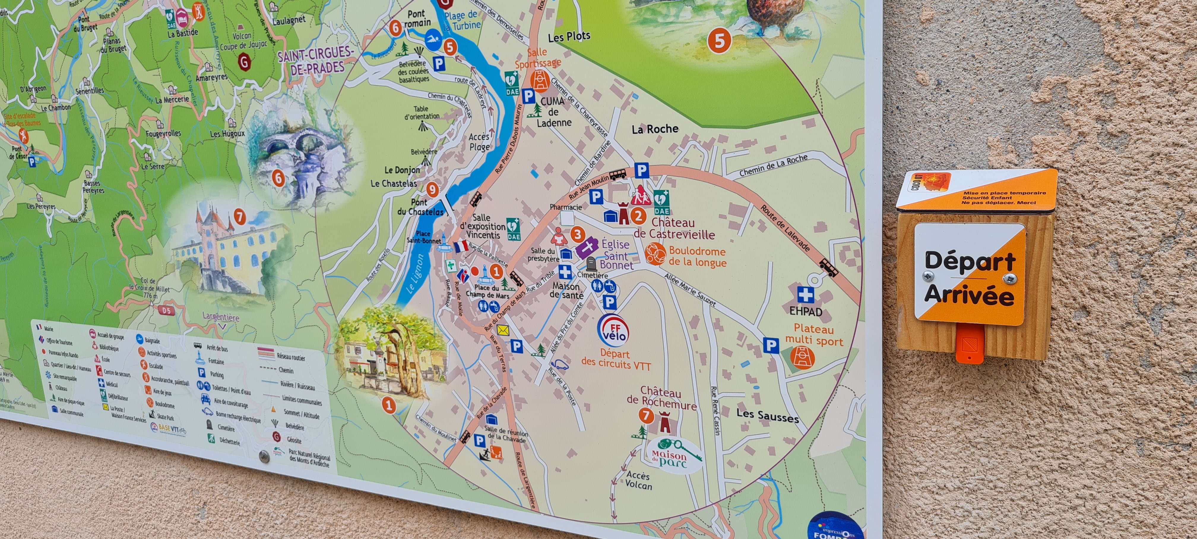
Départ - Jaujac
Krediet: M.BARKATS
- Downloadpdf
Course d'orientation Jaujac vert initiation
Beschrijving
Parcours initiation
Longueur 1km
Longueur 1km
- Vertrek : Tourist office
- Aankomst : Tourist office
- Doorlopende gemeentes : JAUJAC
Weerbericht
details.vigilance
Aanbevelingen
Before leaving, check the weather conditions. Be careful with children when crossing the road. Do not leave any rubbish on the site.
If you notice any anomaly on the route, please contact the Tourist Office.
If you notice any anomaly on the route, please contact the Tourist Office.
A compass and/or a map of the course.
Toegang tot de weg en parkeren
From Aubenas, take the N102 to Lalevade d'Ardèche then turn left onto the D19 towards Jaujac. From the east or north, take the D5 after Neyrac-les-Bains from the N102.
Parkeren :
Church car park - Castrevielle car park - Post office car park
Een probleem of fout melden
Als u een fout op deze pagina heeft opgemerkt of u bent een probleem tegen gekomen tijdens uw wandeling, kunt u dit hier aan ons melden: