
Prades and the Salyndre valley
PRADESPlus d’informations sur les Zones de vigilance →
Prades and the Salyndre valley
Attention : cet itinéraire est concerné par au moins une zone de vigilance élevée. Consultez la section « Zones de vigilance » pour en savoir plus sur les risques et conditions de praticabilité de vos activités.
Gemiddeld
3h
8,8km
+338m
-339m
Rondwandeling
PR
Download dit item om er offline toegang toe te hebben
This green and rolling valley will charm you. An agricultural past where man transformed the landscape. You will discover low walls, béalières and calades.
{count, plural, =0 {Gekoppeld document}} one {Gekoppeld document} other {Gekoppelde documenten}}
- Downloadjpg
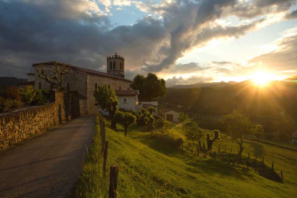
Prades-église
Krediet: Coucher de soleil sur l'église - S.Bugnon-ASV
Beschrijving
- Departure point from the hikes info board at the village square. Take RD 323 and then continue to Margoulier hamlet.
- Take the road on the left in Brousse direction and after 100m take a path to Montférou col.
 You are now at Montférou pass, follow « Lentillères 2.5km » pannel. Follow the way on the right to the village hamlet. Montférou is composed of two occitan words : « Mont » : mountain and « Fero » (férou) : very irritate, furious. Does this mount attract the lightning ?
- At the village hamlet follow the « Prades 6.4 km » pannel.
- You are now at « les Perringues », follow the « Prades 6km » pannel and go on the track for 900m. Splendid view on the Salyndre valley and the Hautes Cévennes mountains.
- Take the path that goes down to the right.
- At the intersection, take right to the RD 323. Cross the RD 323 and take the « Rivier » path.
- After the Rivier hamlet follow the road and after the cross take right. Continue the way following the signs to the village centre to reach back the starting point.
- Vertrek : Village square
- Aankomst : Village square
- Doorlopende gemeentes : PRADES en LENTILLERES
Weerbericht
Hoogteprofiel
details.vigilance
Aanbevelingen
The loop is delineated by yellow and white painting.
Informatiepunten

2 place du Bosquet, Neyrac les Bains, 07380 Meyras
Toegang tot de weg en parkeren
From Aubenas, take the N102 to Lalevade d’Ardèche. At the roundabout take left direction Prades. From the est or the north, on the N102 take the D5 after Neyrac-les-Bains. Once in Jaujac, take Lalevade d’Ardèche direction. Road down for 5 km and take Prades direction on the right.
Parkeren :
Village square
Een probleem of fout melden
Als u een fout op deze pagina heeft opgemerkt of u bent een probleem tegen gekomen tijdens uw wandeling, kunt u dit hier aan ons melden: